NEW: National Weather Service Issues Winter Weather Advisory for Worcester


Monday, December 28, 2015
_360_358_90.jpg)
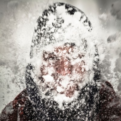
National Weather Service has issued a winter storm advisory for the Worcester area including snow, sleet and freezing rain.
HARTFORD CT-TOLLAND CT-WINDHAM CT-EASTERN ESSEX MA- WESTERN HAMPDEN MA-EASTERN HAMPDEN MA-SOUTHERN WORCESTER MA- WESTERN NORFOLK MA-SOUTHEAST MIDDLESEX MA-SUFFOLK MA- EASTERN NORFOLK MA-NORTHERN BRISTOL MA-WESTERN PLYMOUTH MA- EASTERN PLYMOUTH MA-NORTHWEST PROVIDENCE RI- SOUTHEAST PROVIDENCE RI-WESTERN KENT RI-EASTERN KENT RI- WASHINGTON RI- INCLUDING THE CITIES OF...HARTFORD...WINDSOR LOCKS...UNION... VERNON...PUTNAM...WILLIMANTIC...GLOUCESTER...BLANDFORD... SPRINGFIELD...MILFORD...WORCESTER...FOXBORO...NORWOOD... CAMBRIDGE...BOSTON...QUINCY...TAUNTON...BROCKTON...PLYMOUTH... FOSTER...SMITHFIELD...PROVIDENCE...WEST GREENWICH...WARWICK... NARRAGANSETT...WESTERLY 310 PM EST SUN DEC 27 2015 ..
WINTER WEATHER ADVISORY IN EFFECT FROM 8 PM MONDAY TO 1 PM EST TUESDAY... THE NATIONAL WEATHER SERVICE IN TAUNTON HAS ISSUED A WINTER WEATHER ADVISORY FOR SNOW...SLEET...AND FREEZING RAIN...WHICH IS IN EFFECT FROM 8 PM MONDAY TO 1 PM EST TUESDAY. *
LOCATIONS...INCLUDE PORTIONS OF SOUTHERN...EASTERN...AND SOUTHEASTERN MASSACHUSETTS...AS WELL AS PORTIONS OF NORTHERN CONNECTICUT...AND NORTHERN AND WESTERN RHODE ISLAND. * HAZARD TYPES...SNOW...SLEET...AND FREEZING RAIN. * ACCUMULATIONS...OF SNOW ARE EXPECTED TO BE AROUND 1 TO 2 INCHES WITH LOCALLY HIGHER AMOUNTS...ALONG WITH AROUND A TENTH OR TWO OF AN INCH OF ICE. * TIMING...SNOW WILL BEGIN AROUND MIDNIGHT MIXING OVER AND CHANGING TO SLEET SHORTLY THEREAFTER BEFORE CHANGING OVER TO FREEZING RAIN DURING THE EARLY-MORNING PERIOD ... THEN RAIN BY MIDDAY. * IMPACTS...DANGEROUS TRAVEL CONDITIONS ESPECIALLY FOR THE TUESDAY MORNING COMMUTE ALONG ELEVATED ROADWAYS. ROADS WILL BECOME SLICK AND SLIPPERY WITH JUST ONLY A TRACE OF SNOW AND/OR ICE. VISIBILITIES WILL BE REDUCED ESPECIALLY WITH SNOW. * WINDS...EAST 5 TO 15 MPH WITH GUSTS UP TO 30 MPH. * TEMPERATURES...IN THE LOWER 30S. * VISIBILITIES...ONE QUARTER MILE OR LESS AT TIMES. PRECAUTIONARY/PREPAREDNESS ACTIONS... A WINTER WEATHER ADVISORY IS ISSUED WHEN SNOW AND/OR ICE IS FORECAST TO DEVELOP IN THE AFFECTED AREAS...BUT ACCUMULATIONS ARE EXPECTED TO BE LIGHT. ANY SNOW OR ICE WOULD RESULT IN SLIPPERY CONDITIONS ON UNTREATED ROADWAYS AND SIDEWALKS. WHEN TEMPERATURES ARE BELOW FREEZING...MOTORISTS NEED TO BE ESPECIALLY CAREFUL ON BRIDGES AND OVERPASSES WHERE SLIPPERY SPOTS CAN EASILY DEVELOP. &&
Related Slideshow: The 10 Worst Blizzards in Central MA History


#10 Blizzard of February 2006
#9 Blizzard of December 2010
#8 NEMO 2013
#7 Nor'Easter of '69
#6 Blizzard of February 2003
#5 Blizzard of January 1996
#4 Blizzard of February 1978
#3 April Fool's Blizzard of 1997
#2 Blizzard of January 2005
#1 Great Blizzard of 1888


Related Articles
- Worcester Commuters React to MBTA Mismanagement and Snow Delays
- MA Health Pushes Insurance Application Back Due to Snow
- 6 to 10 Inches of Snow Coming to Worcester Saturday Night
- NEW: Winter Storm Update: Worcester Hits 100 Inches of Snow this Season
- Worcester Already Has Snowiest February on Record
- Disney on Ice Postponed Due to Incoming Snow
- The Worst Snow-Covered Sidewalks and Intersections in Worcester
- Baker Calls on National Guard, Requests More Equipment for Snow Removal
- Worcester’s Top Ten Highest Annual Snowfall Totals
- Worcester is the #1 Snowiest City in the United States
- Help on the Way to Worcester to Assist in Snow Removal
- Worcester Has Spent $4.7 Million in Snow Removal this Winter
- Worcester, Lowell and Boston are Top 3 Snowiest Cities in United States
- Baker and Polito Seek Federal Assistance to Cover Costs from Record Snowfall
- National Weather Service Concerned About Snow Thaw in Worcester
- It’s Freaking 60° Out, Here Are 25 Things to do Before it Snows
- See Where Worcester Ranks for Snowfall in US
- Its Official: Worcester Says It Is Snow Season
- St.Patrick’s Day Parade Route: Park Avenue Covered in Snow
- UPDATE: Worcester Is Back as #1 Snowiest City in the United States
- Worcester DPW Concerned About Potential Flooding When Snow Melts
- We’re #2!: Lowell Dethrones Worcester for Snowiest City in America
- Finneran: Those Snow Drifts Hold Stories
- 15 Who Made a Difference in 2015: Snow


Follow us on Pinterest Google + Facebook Twitter See It Read It