NEW: Extreme Heat Advisory In Central Mass


Tuesday, July 17, 2012
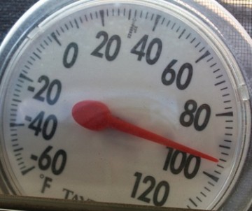
Heat Index values are expected to reach 103, with temperatures in the mid-90s. Dewpoints are predicted to climb to 70.
A heat advisory means that very hot temperatures and high humidity are predicted, and that combination will produce dangerous conditions for those who are outside for a prolonged period of time. Heat illnesses are possible.
Precautions
- To protect yourself against heat-related illnesses:
- Avoid work in the sun and in poorly ventilated areas.
- Reschedule strenuous activities to early morning and evening
- Drink plenty of fluids
- Wear light weight and loose fitting clothing
- Stay in an air conditioned environment
- Check on neighbors and relatives, especially the elderly.
- Anyone overcome by heat should be move to a cool and shaded location.
Experts warn that heat stroke is an emergency. Call 911
Related Articles
- Great Places to Cool Off in Central Mass
- Local Health Experts: How to Stay Cool if You’re Pregnant
- Beating The Heat: Ways to Stay Cool
- NEW: Another Heat Advisory for Worcester County
- NEW: Safety Tips on Heat Stroke Awareness Day
- Five Ways to Stay Cool This Weekend
- Fun Ways to Stay Cool


 Delivered Free Every
Follow us on Pinterest Google + Facebook Twitter See It Read It