Welcome! Login | Register
 

Worcester Police Officer and Local Boy Drown in Accident, and in Braintree 2 Police Shot, K-9 Killed—Worcester Police Officer and Local Boy Drown in…

Person of Interest Named in Molly Bish Case By Worcester County DA—Person of Interest Named in Molly Bish Case…

Bravehearts Escape Nashua With a Win, 9th Inning Controversy—Bravehearts Escape Nashua With a Win, 9th Inning…

Worcester Regional Research Bureau Announces Recipients of 2021 Awards—Worcester Regional Research Bureau Announces Recipients of 2021…

16 Year Old Shot, Worcester Police Detectives Investigating Shooting at Crompton Park—16 Year Old Shot, Worcester Police Detectives Investigating…

Feds Charge Former MA Pizzeria Owner With PPP Fraud - Allegedly Used Loan to Purchase Alpaca Farm—Feds Charge Former MA Pizzeria Owner With PPP…

Facebook’s independent Oversight Board on Wednesday announced it has ruled in favor of upholding the—Trump's Facebook Suspension Upheld

Patriots’ Kraft Buys Hamptons Beach House for $43 Million, According to Reports—Patriots’ Kraft Buys Hamptons Beach House for $43…

Clark Alum Donates $6M to Support Arts and Music Initiatives—Clark Alum Donates $6M to Support Arts and…

CVS & Walgreens Have Wasted Nearly 130,000 Vaccine Doses, According to Report—CVS & Walgreens Have Wasted Nearly 130,000 Vaccine…


Winter Storm Update: Worcester Can Expect a Foot of Snow Monday

Sunday, February 01, 2015


The National Weather Service has updated its report on Monday's snow storm. According to the NWS, a Winter Storm Warning is in effect until 1 AM on Tuesday morning. Worcester and the rest of Central Massachusetts can expect at least 12 inches of snow.

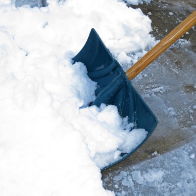
The snow will begin late Sunday night and will continue to fall Monday at a rate of 1 to 2 inches per hour. 

Travel will be difficult with poor visibility and winds up to 35 mph blowing snow.

Here is the full updated report from the NWS:

...WINTER STORM WARNING REMAINS IN EFFECT FROM 9 PM THIS EVENING TO 1 AM EST TUESDAY...

* LOCATIONS...INCLUDES MOST OF MASSACHUSETTS AND RHODE ISLAND AWAY FROM THE IMMEDIATE SOUTH COASTS. THE WARNING ALSO INCLUDES NORTHERN CONNECTICUT.

* HAZARD TYPES...HEAVY SNOW.

* ACCUMULATIONS...SNOW ACCUMULATION OF 6 TO 10 INCHES ACROSS RHODE ISLAND AND SOUTHEAST MASSACHUSETTS...AND AROUND A FOOT IN NORTHERN CONNECTICUT AND THE REST OF MASSACHUSETTS.

* TIMING...SNOW DEVELOPS BEFORE MIDNIGHT ACROSS WESTERN MASSACHUSETTS AND NORTHERN CONNECTICUT AND AFTER MIDNIGHT ACROSS EASTERN MASSACHUSETTS AND RHODE ISLAND. SNOW WILL FALL HEAVY AT TIMES MONDAY MORNING AT 1 TO 2 INCHES PER HOUR...IMPACTING THE MORNING RUSH HOUR. THE SNOW MAY MIX WITH OR BRIEFLY CHANGE TO SLEET ACROSS RHODE ISLAND AND SOUTHEAST MASSACHUSETTS AROUND MIDDAY.

* WINDS...NORTH 10 TO 20 MPH WITH GUSTS UP TO 35 MPH. * IMPACTS...HAZARDOUS TRAVEL IS EXPECTED WITH SNOW COVERED ROADS AND POOR VISIBILITY. BLOWING AND DRIFTING SNOW ALSO EXPECTED... ESPECIALLY ALONG THE COAST.

* WINDS...NORTH 10 TO 20 MPH WITH GUSTS UP TO 35 MPH CLOSER TO THE COAST.

* VISIBILITIES...ONE QUARTER MILE OR LESS AT TIMES. PRECAUTIONARY/PREPAREDNESS ACTIONS

 A WINTER STORM WARNING IS ISSUED WHEN AN AVERAGE OF 6 OR MORE INCHES OF SNOW IS EXPECTED IN A 12 HOUR PERIOD...OR FOR 8 OR MORE INCHES IN A 24 HOUR PERIOD. TRAVEL WILL BE SLOW AT BEST ON WELL TREATED SURFACES...AND QUITE DIFFICULT ON ANY UNPLOWED OR UNTREATED SURFACES.


Related Slideshow: The 10 Worst Blizzards in Central MA History

Prev Next

#10 Blizzard of February 2006

Dates: February 11-13, 2006

Accumulation: Approximately 22 inches

This Nor'easter interrupted everybody's Valentine's Day plans, and resulted in coastal flooding and heavy snow.

Prev Next

#9 Blizzard of December 2010

Dates: December 22-29, 2010

Accumulation: Approximately 24 inches

A State of Emergency was declared in Boston when this Christmas storm hit and kept families home for the holidays. Worcester saw two feet of snow during this white Christmas.

Prev Next

#8 NEMO 2013

Dates: February 7-18, 2013

Accumulation: Approximately 25 inches

NEMO singlehandedly shut down every road in Worcester. Dropping more than two feet of snow in the city, a driving ban was put into effect.

Prev Next

#7 Nor'Easter of '69

Dates: February 8-10, 1969

Accumulation: Approximately 26 inches

Bryan Adams didn't write a song about Nor'Easter of '69 because it would have been miserable to listen to. Even worse to experience.

Prev Next

#6 Blizzard of February 2003

Dates: February 14-19, 2003

Accumulation: Approximately 27.5 inches

This storm interrupted both Valentine's Day and President's Day. Named 'President's Day Storm II,' this storm set a record in Boston with more than 27 inches.

Prev Next

#5 Blizzard of January 1996

Dates: January 6-10, 1996

Accumulation: Approximately 30 inches

Not even a week into 1996, this storm blanketed parts of Massachusetts with upwards of 30 inches of snow. It is one of two blizzards to receive an “extreme” rating on the Northeast Snowfall Impact Scale.

Prev Next

#4 Blizzard of February 1978

Dates: February 5-7, 1978

Accumulations: Approximately 32 inches

Many in the Worcester area argue that this is the worst storm the city has ever seen. 73 people in Massachusetts died because of this storm. At the time, it set a Boston record for 32 inches of snow over a 2 day period. 

Prev Next

#3 April Fool's Blizzard of 1997

Dates: March 30 - April 1, 1997

Accumulations: Approximately 33 inches

This storm wasn't messing around with anyone. Over three days, and ending on April Fool's Day, the storm dropped 33 inches of snow on Central MA.

Prev Next

#2 Blizzard of January 2005

Dates: January 20-23, 2005

Accumulations: Approximately 40 inches

This three-day storm droppped nearly 40 inches of snow in Central Massachusetts over a 3 day period.

Prev Next

#1 Great Blizzard of 1888

Dates: March 11-14, 1888

Accumulations: Approximately 50 inches

One of the most severe recorded blizzards in the history of the United States, this superstorm dumped as much as 50 inches of snow in parts of Massachusetts. It affected the entire country.

In New York City, they suffered so much damage to power lines and cables, that this storm single handedly is responsible for implementing running cable underground.


(Stereoview picture of Grand Street in New Britain, Connecticut, published by F. W. Allderige in 1888)


Related Articles


Enjoy this post? Share it with others.


X

Stay Connected — Free
Daily Email